
Leave the crowds at Snowdon or Pen‑y‑Fan behind and consider climbing Cadair Idris in Southern Snowdonia instead. With different routes to tackle and some of the national park’s best scenery, the Cadair Idris walk never gets boring. Hasnaa Mike Krawec gives you all the details.
I’m lucky to live near this amazing 893 m (2,930 ft) high mountain in Wales, and I’ve completed the Cadair Idris walk several times. Whichever route you choose, I can guarantee an epic walk with stunning views over the Gwynedd landscape 🌿, including the Barmouth estuary and even out towards Ireland.
📚 Table of Contents
Cadair Idris Walking Routes:
Pony Path 🐴
Minffordd Path
Llanfihangel y Pennant Path
An Account of My Last Walk up Cadair Idris
Getting to Cadair Idris:
By Car 🚗
By Train 🚆🚆
Tips for Walking Cadair Idris
Accessibility of Cadair Idris
There are three main walking routes to the summit of Cadair Idris, each offering a slightly different experience. 🏔️
But first of all, anyone planning to climb should know that whichever route you choose will be a strenuous walk ⏱️. The terrain is varied with challenging climbs, so you should have a good fitness level and some mountain walking experience. The time it takes may be longer than the estimates provided.
Cadair Idris Walking Routes:
Pony Path 🐴
- It starts at the Tŷ Nant car park.
- One of the most popular routes to reach the summit.
- The route is approximately 9.3 km / 5.7 mi and takes around 4 to 5 hours to complete.
Minffordd Path
- A similar distance to the Pony Path, about 10 km / 6 mi, with the same estimated time of 4 to 5 hours.
- But it’s much steeper for those looking for a challenge.
Llanfihangel y Pennant Path
- The longest of the three routes, about 16 km / 10 mi.
- Some people say it’s the easiest in terms of walking.
- Walkers should allow around seven hours to fully complete it.
An Account of My Last Walk up Cadair Idris
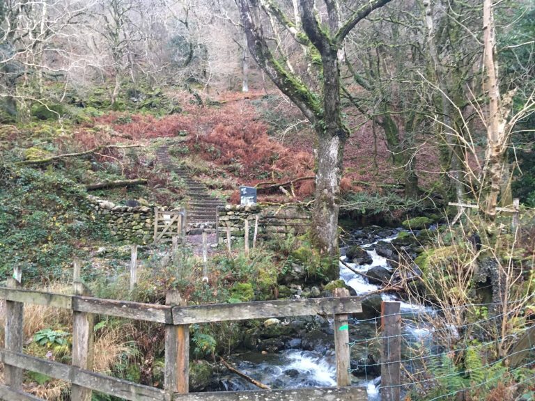
The last time I climbed Cadair Idris was in the depths of winter ❄️, on a cold, crisp day with brilliantly clear skies – at least at the start.
I chose the Minffordd Path for this ascent, as I hadn’t walked it before and fancied a challenge since it’s the steepest route ⛰️.
The start from the Dôl Idris car park is easy to navigate and well signposted, but the climb up the stone steps begins almost immediately, and I felt my legs burning from the very first moment! 🔥
From the very first moment, I felt the magic of the place I was in. Steeped in history and folklore, and coupled with the magnificent scenery—trickling streams, lush green fields, and hand-built stone walls—it’s hard to find a more beautiful spot in Wales 🌿.
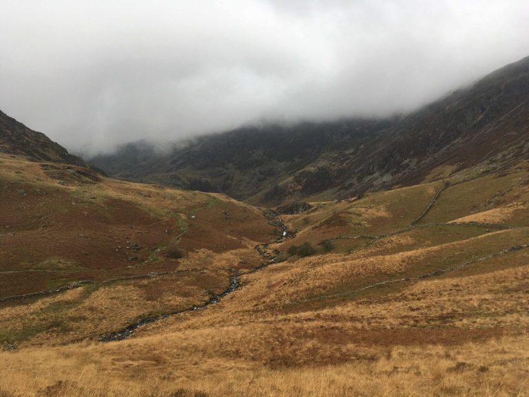
After tackling the first set of steep steps and passing small waterfalls and streams, I soon arrived at Llyn Cau (the Closed Lake) 🌊, which sits at the bottom of a dramatic crater formed by melting glaciers.
For me, this is the most special part of the entire walk. It feels like a surprising and beautiful moment when you arrive at this natural lake beneath jagged mountain walls about 400 m high, roughly halfway up the walk.
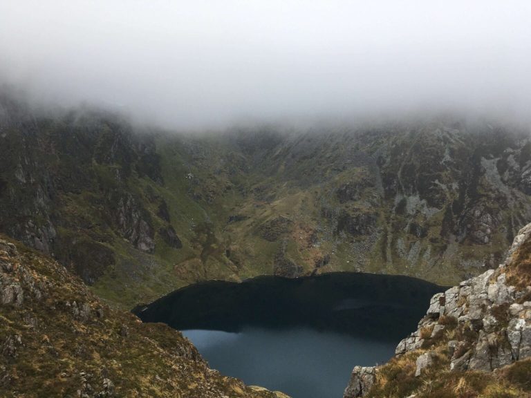
This tranquil, deep-blue lake 🌊 was the perfect spot to relax for a while, reflect, and enjoy the peaceful surroundings. And that’s exactly what I did. For those feeling braver, you can dip your feet in or even go for a swim! 🏊
I was glad I took some time to relax here – because the climb after the lake was much tougher. The fairly gentle path now turned into loose rocks and shale on a steep gradient ⛰️.
It’s important to say that anyone with a decent fitness level, including children, can navigate the Minffordd Path from the base of the mountain to Llyn Cau without any problems. But beyond the lake, the real challenges begin – you’ll need some experience in mountain walking and navigation.
I pressed on, although at this point the weather began to turn 🌫️, with heavy fog and clouds rolling in, and I wondered whether I should turn back.
Nevertheless, I persevered, glad I had packed some extra layers – like long-sleeve, skin-tight training tops, lightweight and easy to carry but offering good protection against the elements. Coupled with a waterproof or ski jacket, you don’t need much else (temperatures rarely drop below zero, though the wind can be biting).
The final part of the ascent involved a bit of scrambling, where I used my hands and feet on the loose rocks and shale to prevent slipping.
Finally, I reached the summit after 2 hours and 45 minutes ⏱️, took some time to refuel and rest in the old stone building, and of course, visited the monument that adorns many of the country’s highest peaks.
I was a bit disappointed not to see the fabulous views from the summit (also known as Penygadair), including the Barmouth estuary, but unfortunately the weather obscured the view.
But I can assure you, on a clear day, the views from the summit are truly stunning 🌄.
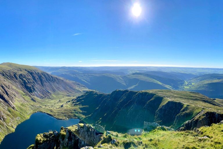
For the descent, the path is simply the reverse of the ascent – gentle at first, but soon becoming very steep in places ⛰️.
The signposts could be a little clearer, as at one point I missed the path and ended up walking in the wrong direction! 🔄
Typically, the weather improves during the descent, making visibility much clearer and navigation easier as a result 🌤️.
I managed to descend in just over 2 hours, making the total hike time on the Minffordd Path just under five hours.
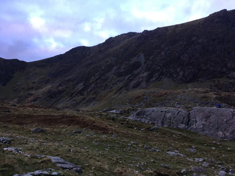
I can honestly say the whole walk was a big challenge, and I definitely needed a few days’ rest afterward 😅. Luckily, the drive home was short, so I could take a shower, put my feet up, and enjoy some good food 🍽️!
If you’re a keen walker or hiker, the chance to summit Cadair Idris shouldn’t be missed – it’s one of the best mountains in Wales 🏔️. Personally, I prefer it to Snowdon (Yr Wyddfa), as it has a more magical feel, and Llyn Cau is an unexpected natural wonder.
If you’re staying locally, you’ll find plenty of friendly people happy to provide useful information to help plan your Cadair Idris walk.
Getting to Cadair Idris
The mountain is located in the southern part of Eryri (Snowdonia), and the best way to access it is by car 🚗, though there are other options:
By Car
- There are three car parks: Dôl Idris (Minffordd), Llanfihangel y Pennant, and Tŷ Nant.
- The Dôl Idris and Tŷ Nant car parks are run by the National Park, and there’s a fee to use them – make sure to bring the correct change as the machines don’t give any 💷.
By Train
- There are train stations in the nearby towns of Machynlleth, Dolgellau, and Tywyn.
- However, the start of the Cadair Idris walks is still a bit away, so you’ll need to arrange onward transport from the train stations 🚆.
Tips for Walking Cadair Idris
Some of the car parks require payment, so make sure to bring the correct change.
Try to arrive early, as the car parks are small and fill up quickly.
The Minffordd route starts near the visitor centre, which also has a café and toilets ☕🚻.
It’s advisable to undertake your Cadair Idris walk between May and September due to favorable conditions.
Conditions on the mountain can change dramatically and without warning, so you should bring a rain jacket and extra layers.
Don’t be afraid to turn back if visibility is poor.
The nearby beautiful towns such as Machynlleth, Dolgellau, or Tywyn are excellent for staying.
Easy access to the summit of Cadair Idris.
Unfortunately, the mountain is not suitable for wheelchairs due to stairs and steep climbs ❌.
However, there is wheelchair access to the visitor center and the tea room. ☕
Starting points and landmarks on the Cadair Idris hike.
📍 Pony Path
Code: LL36 9SY — One of the popular parking areas to access the summit of Cadair Idris via the Pony Path, close to the trailhead and clearly signposted.
📍 Minffordd Path
Code: LL36 9SY — Trailhead for the Minffordd Path, close to the visitor centre with a café and toilets; the mountain car park is managed by the national park (fees apply).
📍 Llanfihangel-y-Pennant Path
Code: LL36 9SB — The starting point of the longest route up Cadair Idris, suitable for long-distance hikers. Walkers should allow around seven hours to fully complete it.
📍 Cadair Idris Visitor Centre & Tea Room
Code: LL36 9SY — Visitor centre for information seekers, rest and coffee, wheelchair accessible, and a good planning point before the ascent.


Comment (0)