Do you have a local walk you’re proud of? 🌄
The Wainstones Circular Walk in North Yorkshire is a moderate challenge, taking you among the famous sandstone rocks, grassy moorland, and breathtaking views stretching across Teesside.
When I was little, the inspiring North Yorkshire Moors were my legendary playground right outside my doorstep 😎
Wide meadows carpeted with pink flowers you can wander through, the largest collection of ancient trees in northern England for climbing, and empty sandy coves to run and play in like we’ve shipwrecked 🚶♀️
But as I grew older, I realized just how incredible the North York Moors National Park is.
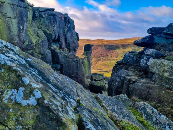
For example, the Wainstones—distinctive massive sandstone rocks in the northwest of the Cleveland Hills. They stand there large, as if about to topple from the hilltop ⛰️
And it’s not just a collection of cool rocks that spark childhood fun for climbing and hiding—no, there are also Bronze Age carvings, giving the place a rich layer of ancient human history.
Local stories say a Viking chieftain was defeated on this hill by the Angles, and the name “Wainstones” comes from the old word “Wanian,” meaning sorrow or grief.
And the Wainstones overlook almost all of Teesside, including Roseberry Topping, the Captain Cook monument, and the North Sea 🌊
Surrounded by the wild moorland of Cold and Urra, along with old barns and stone farms, it’s considered one of the most visually stunning walks in North Yorkshire.
The Wainstones Circular Walk, a moderately challenging 13–15 km route, is one of the most iconic walks in the area to enjoy all the scenery.
If I want to show someone my best local walk and give them a good workout, I’d definitely take them on the Wainstones Circular 💪
Here’s an account of my latest jaunt there.
Walk Key Stats: 📊
- Length: 13 km / 8 miles (or 15 km / 9.3 miles from Great Broughton)
- Duration: 3 – 4.5 hours ⏱️
- Difficulty level: Moderate – challenging
- Type: Circuit
- Elevation gain: 645 m
- Starting point(s): Clay Bank, Chop Gate (or Great Broughton, but add on 2.5 km / 1.5 miles)
- Terrain: Mixed – rocky, muddy/boggy, grassy footpaths, small sections on road, and some stone paths
- Accessibility: Unsuitable for wheelchair users or people with mobility issues
Postcode: YO18 8SJ
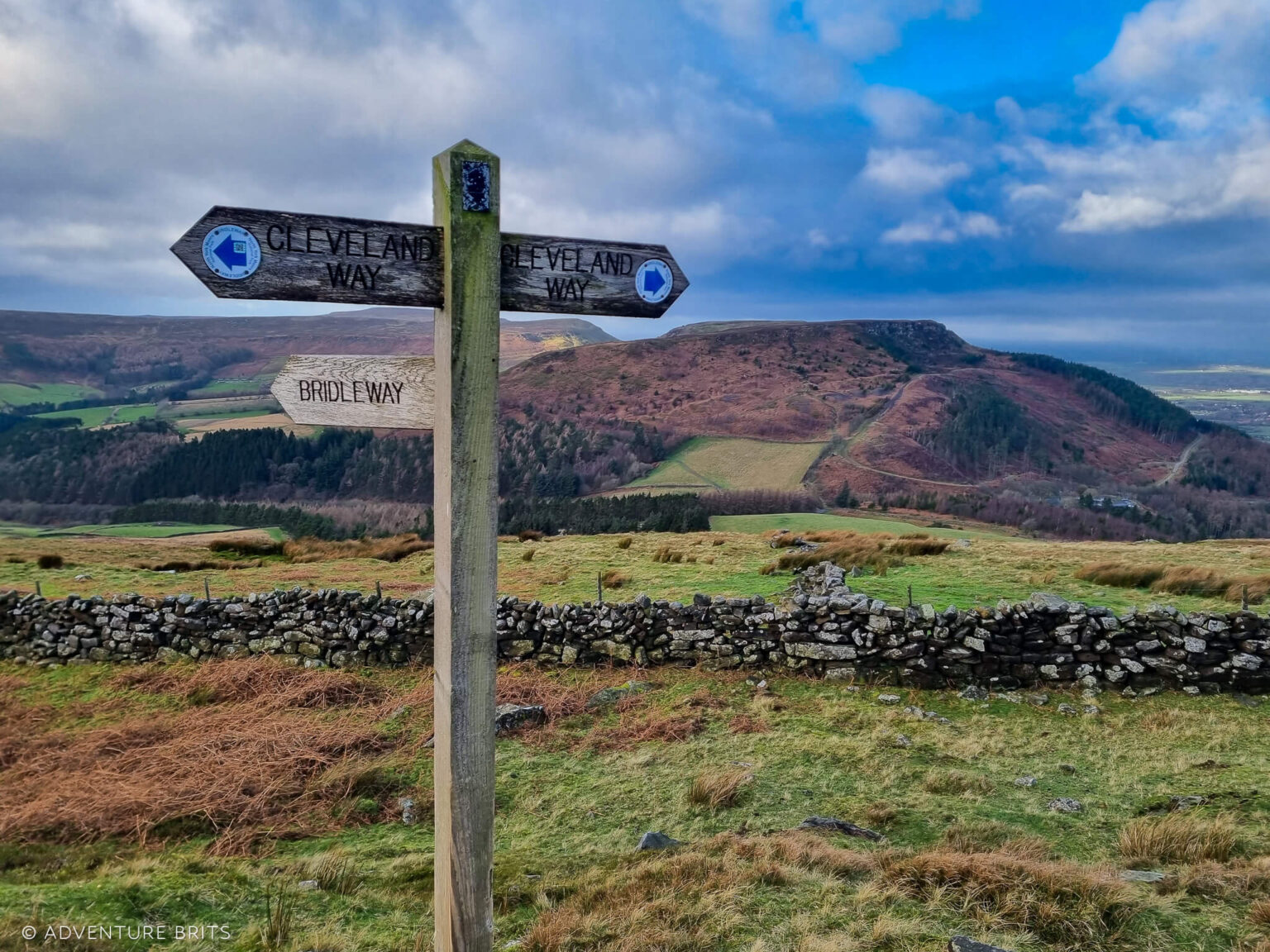
The Wainstones Circular Walk typically starts from the village of Chop Gate or from the Clay Bank car park 🚗
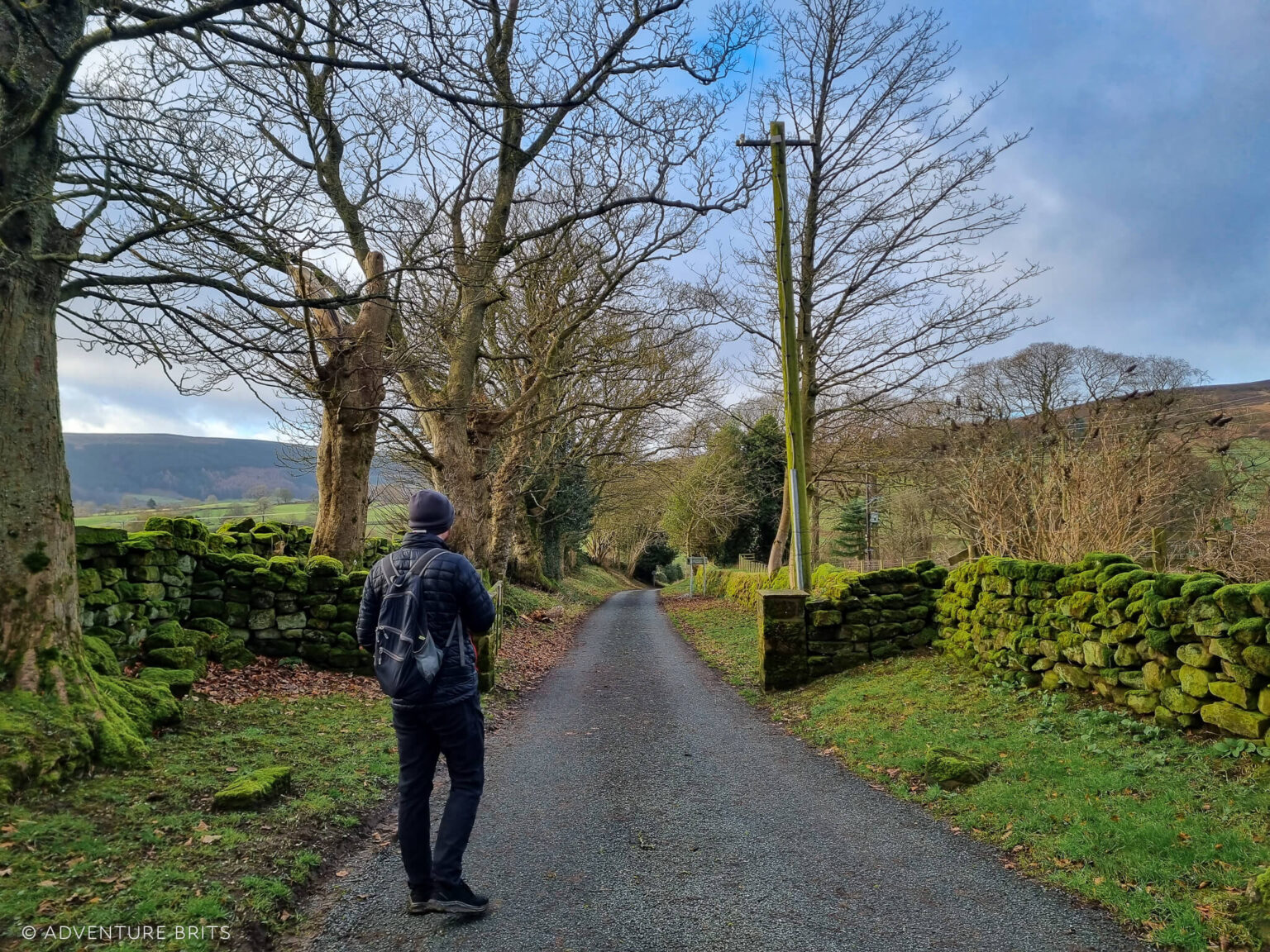
As we live north of the North Yorkshire National Park, we made our own starting point from a quiet lane south of Great Broughton to join the top of the circuit instead of the traditional start.
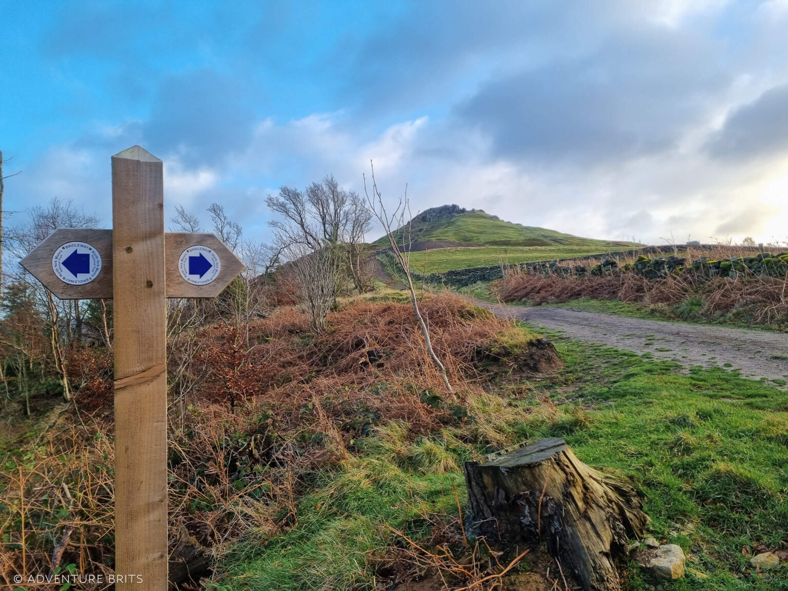
Starting from Great Broughton had us zig-zagging up a steep bridleway through the forest to join a path just below the Wainstones 🌲
According to AllTrails, this path through Broughton Plantation is a no-access route. That’s incorrect, as it’s clearly a signposted public bridleway.
Starting the walk from Broughton added roughly 2.5 km / 30 minutes of extra walking to reach the trail, with quite a bit of ascent! 💪
Overall, via Great Broughton, the route was 15 km / 9.3 miles. It took us three hours and 40 minutes at a very decent pace of 4.2 km/hour – not bad, especially considering the elevation gain.
Typically, the Wainstones Circular Walk from Chop Gate is just over eight miles and takes around three to four hours.
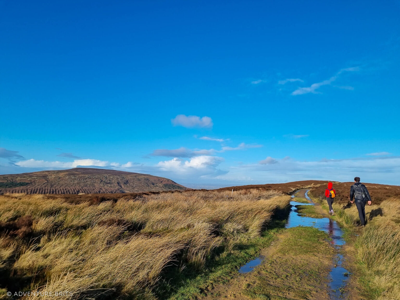
As we joined the Cleveland Way in the December drizzle, the Wainstones beckoned first, drawing us clockwise along the route 🌧️
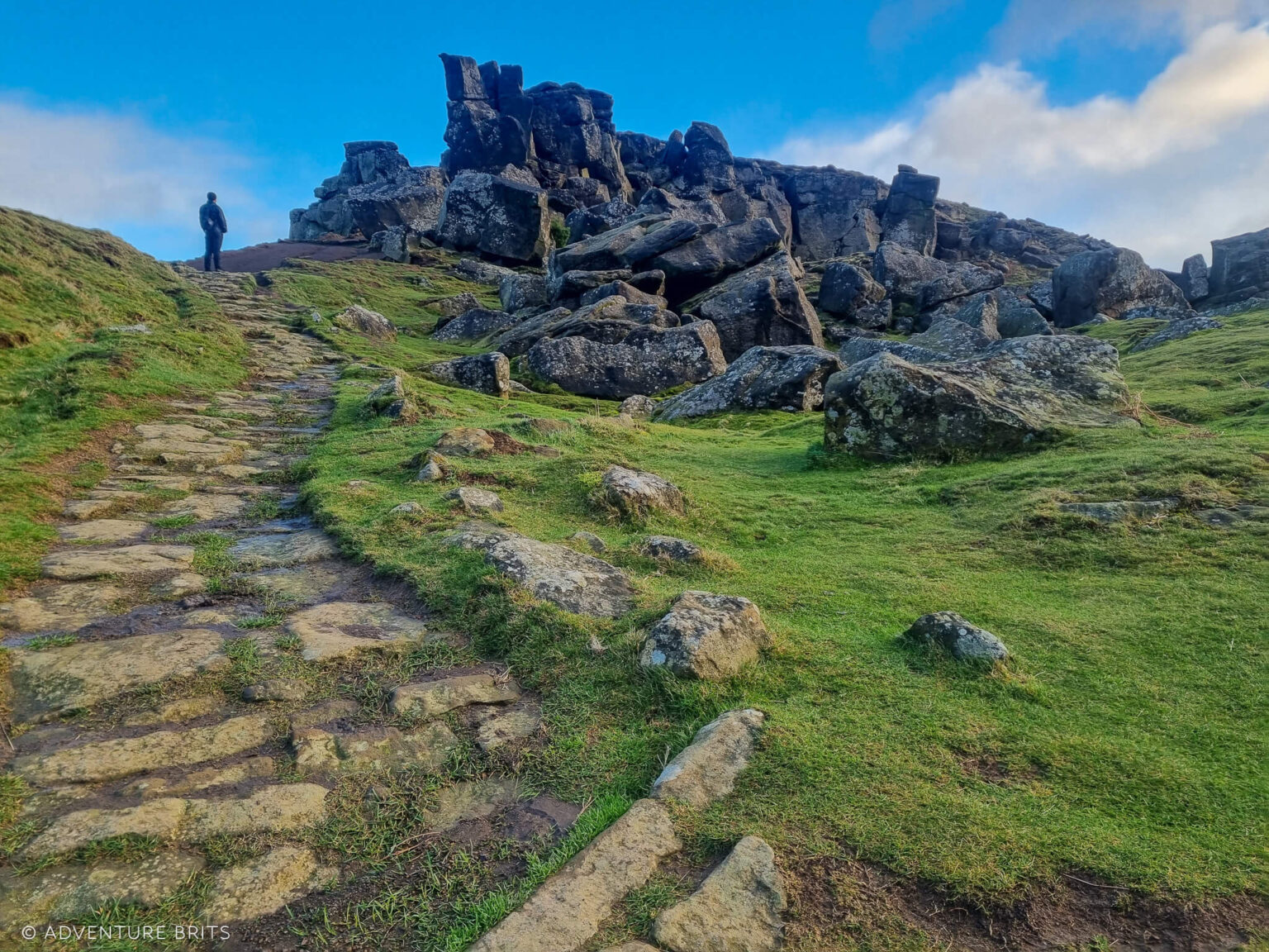
After a short incline up a stone path, we reached one of the highest points in the North Yorkshire Moors.
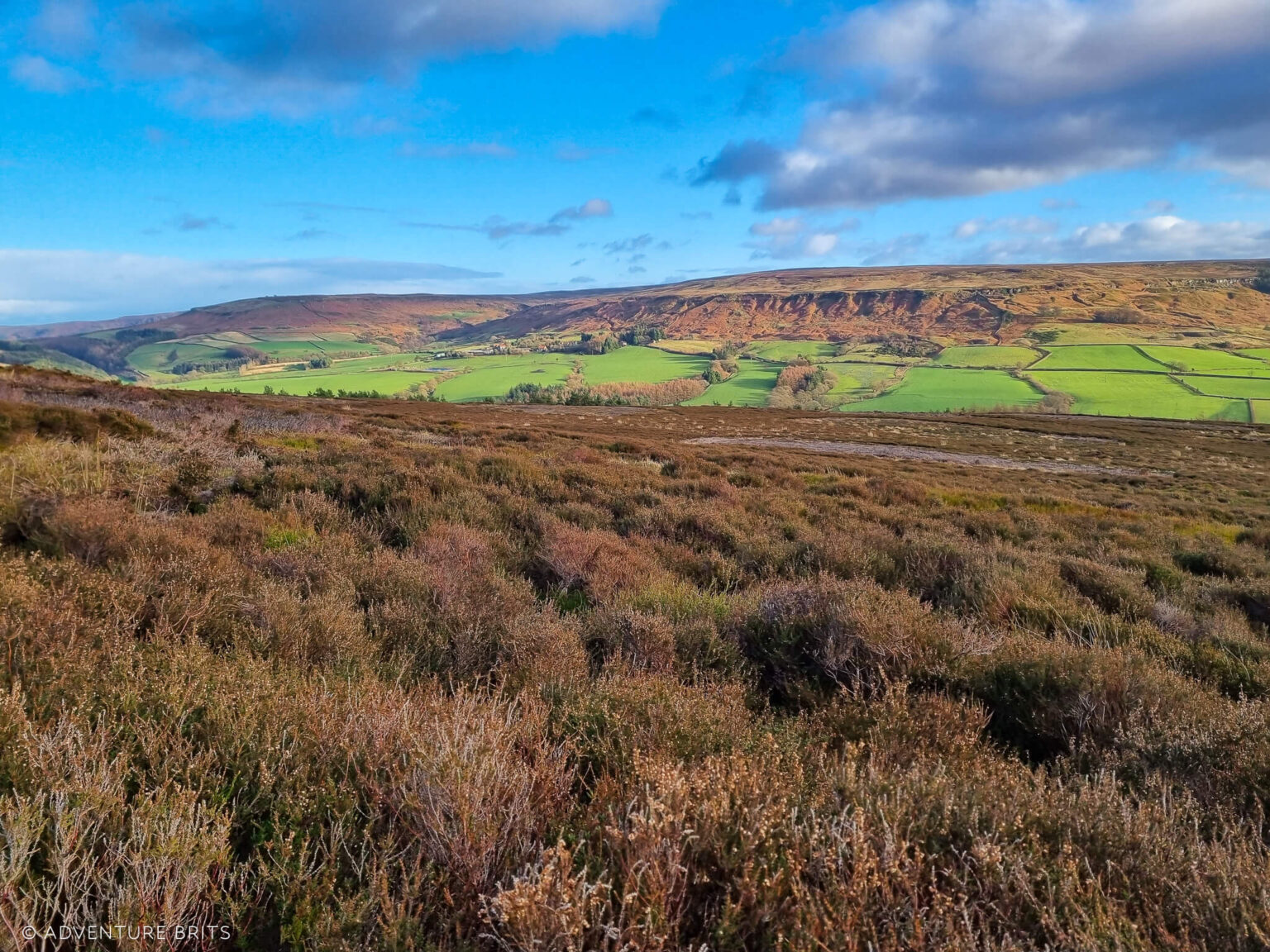
To the north, there are stunning, incredibly expansive views across all of Teesside, including Middlesbrough 🌄
A patchwork of fields with clusters of villages and towns stretches so far, they eventually disappear into the misty horizon.
To the southwest, equally mesmerizing undulating moorland and hills unfold.
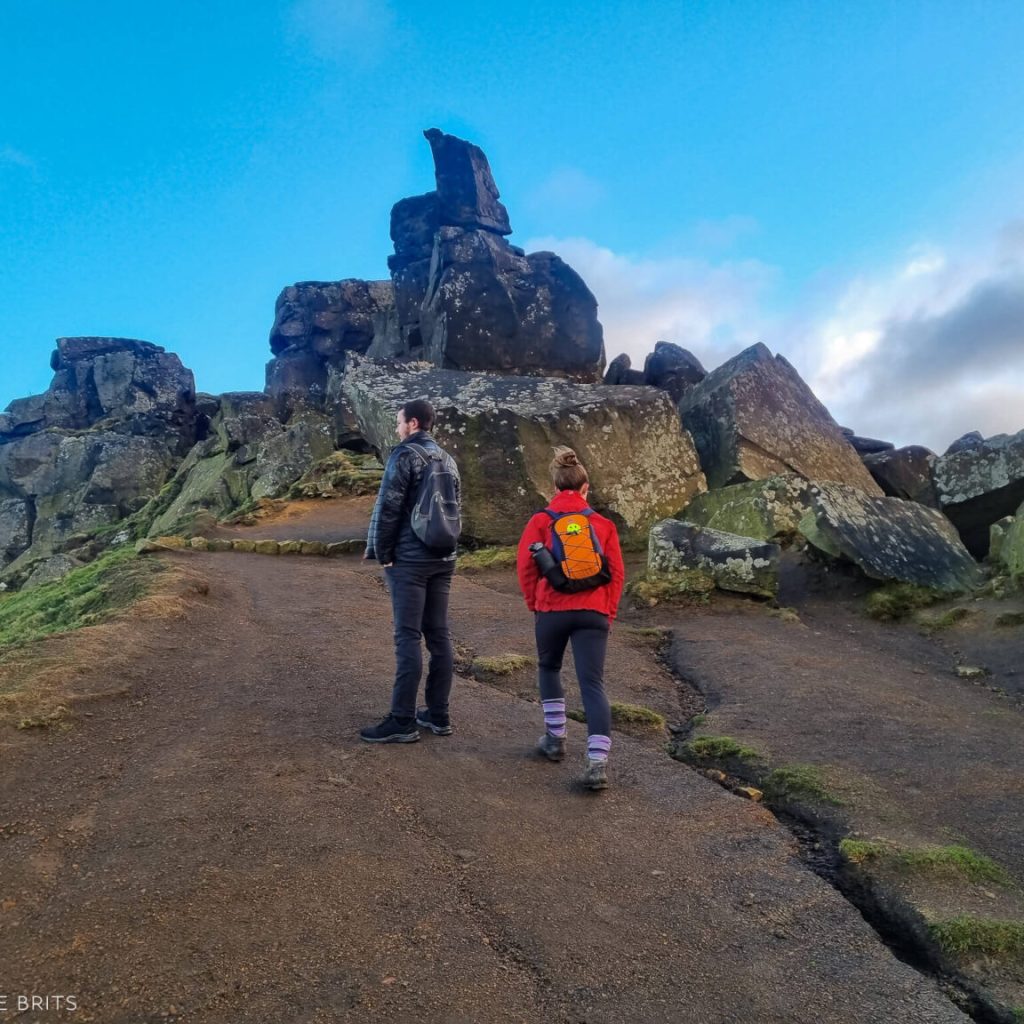
Up close, the Wainstones are monumental. We took our time climbing around the vast sandstone rocks, squeezing through openings and feeling their cool solidity.
My sister, Hasnaa, a rock climber, was watching the crags with wide-eyed interest, silently planning her imaginary routes 🧗♀️
The Wainstones are actually a very popular spot with climbers. They’re said to be one of the original climbing locations in the North Yorks National Park, with several excellent routes of mixed grades.
If you’re interested, check out this cool map of climbing routes on the Wainstones for more info.
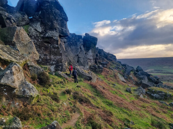
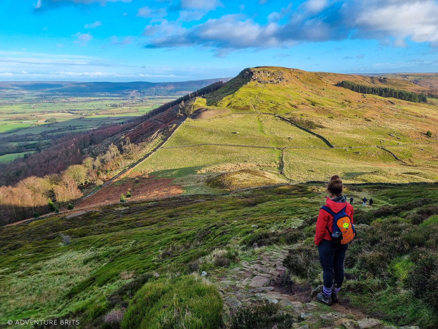
Avoiding the dirt trail decoys around the side (which take you off course), we headed straight up above the stones to join Hasty Bank, just as the winter sun made its glorious appearance ✨
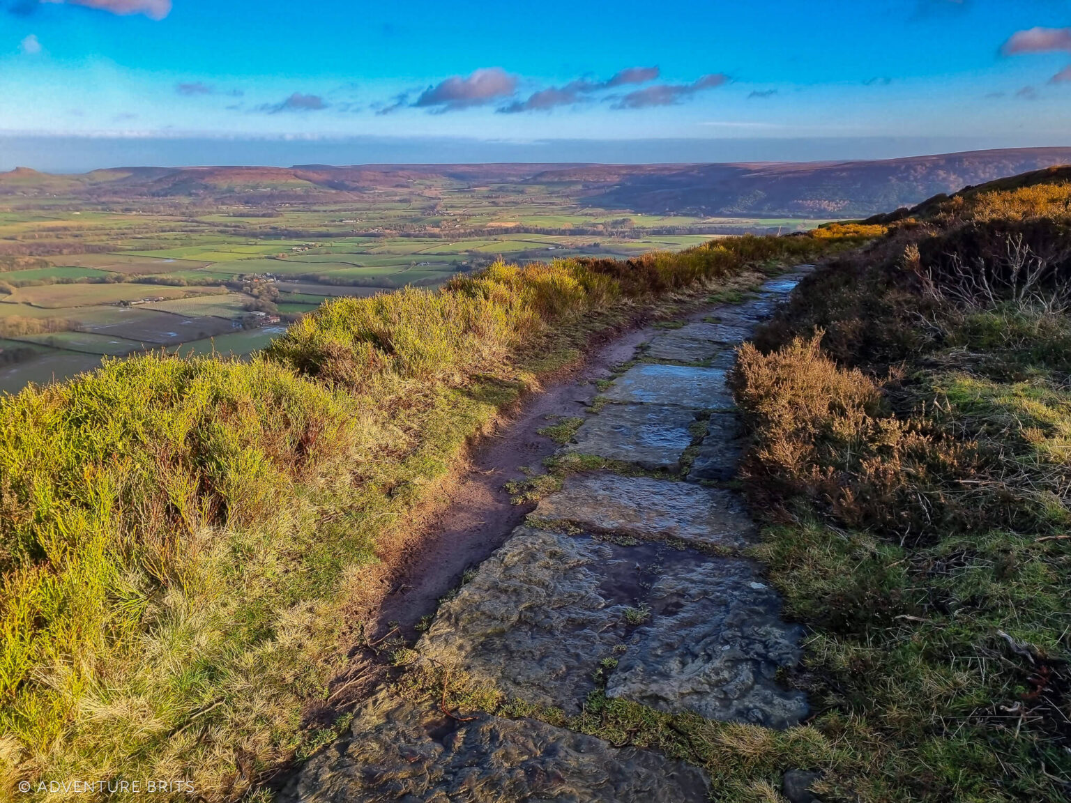
The top section of Hasty Bank offers several exciting and exposed kilometres.
Despite the fierce wind, this is my favorite section of the Wainstones Circular Walk.
The wind whipped us so hard, we were forced into silence 🤯
Partly because we couldn’t hear each other, and also because the air was so strong, it actually felt really hard to breathe.
Despite the wind, this is my favorite section of the Wainstones Circular Walk.
It feels as though you’re walking along an exposed ridge, narrower than it actually is, high above the world. Like a bird. Looking down, removed from it all. At least on one side of the bank.
Following the stone path, we soon reached steps, signaling the start of our descent from the bank 🪜
At the bottom, we carefully crossed the B road at Clay Bank Top (cars really speed by here) and took the wooden gate opposite, to start a short climb up to Urra Moor 🌿
And honestly, it was a really tough climb!
The ascent up to Urra Moor was slow and sweat-inducing 😅
Even though it was midwinter, we were burning up under our layers.
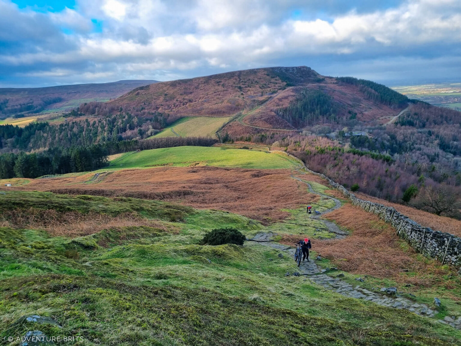
We played a constant game of catch-up with a family of mountain bikers, which was really fun. When the incline wore them out, they gave up riding their heavy bikes and started pushing them—our chance to overtake. Shortly after, they’d pass us again on their bikes, and this went on about five times! 🚴♂️
Finally, at the top of Urra Moor, we were grateful for some flat terrain and a moment to shed a layer of clothing.
Immediately, we hooked along a bridleway to our right, following the very boggy path through the heathland, which at times turned into small streams 🌊
Waterproof footwear is essential here, like my trusty Altberg Tethera hiking boots.
Soon we had to jump over the small Bilsdale Beck, and somehow managed to avoid falling in despite the slippery, muddy bank 😅
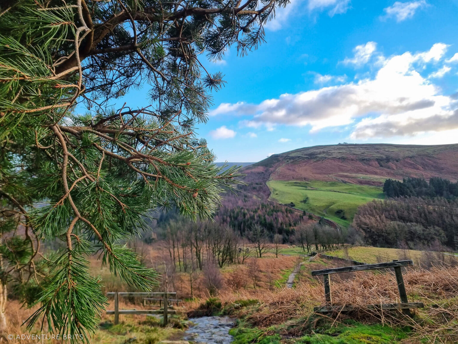
After several kilometres of walking through the exposed moorland, with startled grouse jumping out at us at intervals (scaring us right back!), we took a path down to our right towards Town Green 🌾
We passed through a wooden gate between a gorgeous stone wall and descended past remnants of an old barn 🏚️
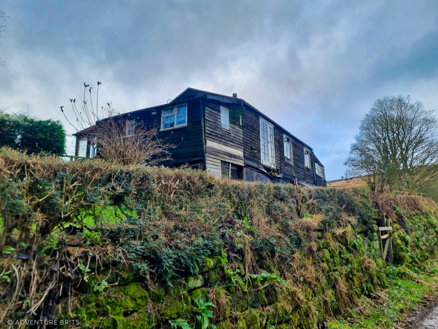
Soon we approached what looked like a derelict wood-clad house with cute white curtains, and we stopped in our tracks, amazed 😮
For a few minutes, we wondered who once lived here and what made them leave the house to fall into ruin in such a beautiful setting.
We turned left out of the second gate down the road towards town, crossing Bilsdale Beck again, this time over a bridge 🌉
Since we didn’t start from Chop Gate, we didn’t feel the need to go all the way south through town and come back 😅
Instead, we took the public footpath opposite us, crossed the B1257 road in Town Green, skirted a very muddy turnip field, and rejoined the track on Cold Moor Lane 🌾
We reached Cold Moor through a wooden gate at the top of the lane and followed the footpath to the right, skirting along the stone wall and past a pine plantation, which slowly led us up to the top 🌲
Cold Moor, a long whaleback moorland, stretches between the valleys of Raisdale to the west and Upper Bilsdale to the east. It’s carpeted with bilberry bushes that gradually give way to long grasses and heather toward the end.
Cold Moor is breathtaking 😍 wide and open, but it drops steeply at the edges. We could spot the Wainstones on Hasty Bank to our right, signaling the approaching end of the walk ⛰️
At the end of Cold Moor, we turned right and zigzagged down the stone path, which became a bit tougher on the knees at this stage of the walk 😅
Watching my younger siblings dash ahead, I took it nice and easy, step by step.
We exited through the gate we entered, descending the winding road through the plantation back to the car, shaking the mud off our muddy boots along the way 👢
Call this a local walk? Absolutely – we’re really lucky here in the Moors! 🌿 🌿


Comment (0)